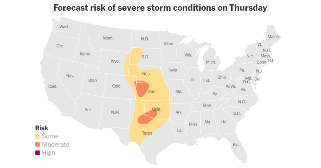
Severe weather season has begun across the Plains, with forecasters predicting four days of severe weather, including tornadoes and large hail.
The danger zone extends from South Dakota to southern Texas starting Thursday and moving east into Sunday. Cities such as Oklahoma City, Kansas City, and Dallas could experience severe storms at some point during the period.
Here's what happens and when it happens.
Thursday will see hailstones up to 3 inches in diameter and tornadoes.
Golf ball-sized hail fell in parts of northwestern Kansas and near Nebraska on Thursday night, and at least three tornadoes were reported, one near Yoder, Wyoming and one near Akron, Colorado. , and the other near Bird City, Kansas. , National Weather Service meteorologist Richard Bunn said by phone Thursday.
He noted that there were no immediate reports of damage, but several other tornado warnings and watches had been issued.
Large hail is also possible in northwest Texas and central Oklahoma late Thursday into Friday morning. A few tornadoes are also possible in the area, but the risk is lower.
Threat moves slightly east on Friday
Tornadoes are expected to hit parts of Nebraska, Iowa, Kansas and Missouri, including Kansas City, on Friday, and some could strengthen.
The heaviest storms are likely to occur in the afternoon and evening, potentially causing hail and wind damage.
Same pattern on Saturday
On Saturday, the risk extends further from Texas to Michigan, including Dallas and Milwaukee.
The greatest threat of strong tornadoes will once again return to the south-central Plains, including Oklahoma City and Kansas City. Hail the size of golf balls to baseballs is possible, and winds could cause damage.
Sunday is uncertain
The threat of severe thunderstorms will continue into Sunday, but the exact location of the most dangerous areas is unclear, forecasters said Thursday.


