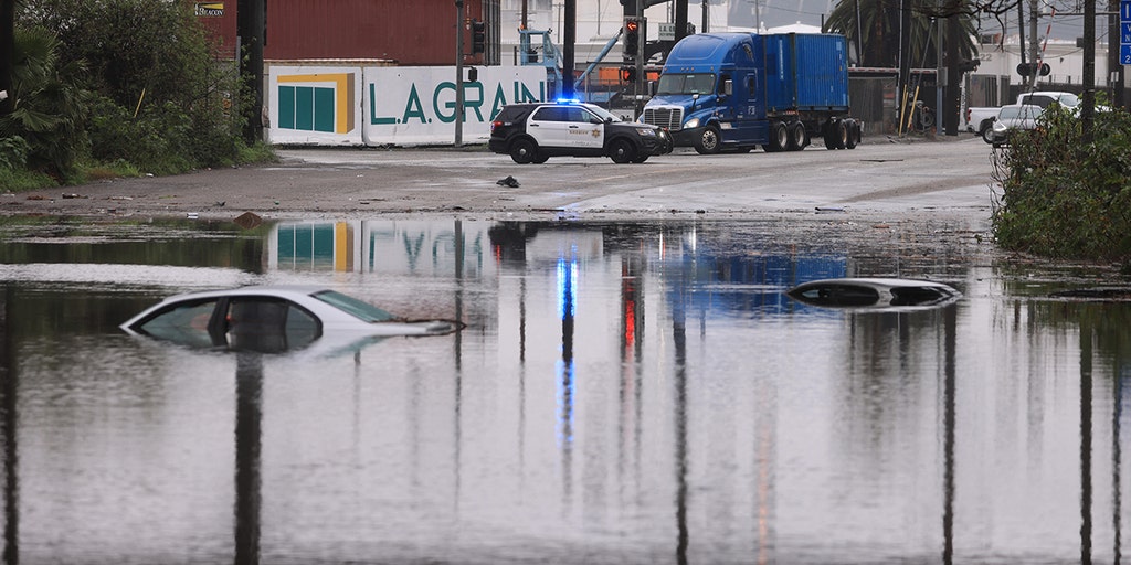
Dangerous flooding looms in Southern California
A low-pressure system will approach the California coast on Sunday, bringing large amounts of moisture from the tropics.
Los Angeles – California is taking a brief respite from extreme weather after being hit with record rain and snow from the Pineapple Express atmospheric river event on Thursday. But another powerful and even more powerful storm is already approaching from across the Pacific Ocean, and rainfall totals could be even higher.
The National Weather Service (NWS) in Los Angeles has already used strong language in its forecast, indicating a significant threat of widespread and dangerous flash flooding Sunday into Monday.
“Life-threatening flooding conditions are shaping up, especially Sunday through Monday,” the NWS said in a forecast discussion Thursday night.
How to watch Fox Weather
Watch Saturday night's exclusive FOX Weather Futuretrack. (FOX Weather)
'Extreme' rainfall totals possible across Southern California
The FOX Prediction Center says a low-pressure system will send another atmospheric river toward the California coast on Sunday, bringing in tons of moisture from the tropics.
Unlike the last system, this storm is in no hurry to leave. This will continue to send rivers of atmospheric moisture toward California for two to three days.
What is an atmospheric river?
“The last atmospheric river event we had, there was movement,” said FOX Weather meteorologist Britta Merwin. “There will be less movement this time, and rainfall totals could be much higher.”
Rain will hit all of California, but it's becoming clear that the area of greatest concern is along the southern coast all the way to the Los Angeles Basin, the FOX Prediction Center said. The heaviest rain will fall from Sunday into Monday, with peak rainfall occurring Sunday night.
More than 5 inches of rain could fall in the Los Angeles metro Sunday through midweek, with totals likely to approach 8 to 9 inches in the mountains.
Rain is forecast for the Los Angeles area through Wednesday, February 7th. (FOX Weather)
“This is the kind of rain they can't handle,” Merwin said. “This is a guaranteed flood setup. There's no way around this. We know it's going to be bad, and there's going to be a big impact.”
The storm comes on the heels of Thursday's soggy Pineapple Express storm, which already leaves Southern California's soils supersaturated. A record 2.45 inches of rain in Long Beach on Thursday flooded highways, including busy Interstate 710. Los Angeles also set a single-day record for rainfall with 2.49 inches.
“With the ground already saturated from (Thursday's) rain, the next quake will likely cause dangerous flash flooding even faster,” NWS Los Angeles forecasters said. “And everyone, especially those near or in south-facing mountains, should start preparing now for potential evacuations during or before the storm hits. ”
Rain forecast for San Diego area through Wednesday, February 7, 2024 (FOX Weather)
On Sunday, the risk of flash flooding was announced as Level 3 out of 4 for coastal areas of central and southern California, and by Monday it had spread south to the Los Angeles area.
“This shows confidence that we know this is going to be a bigger storm,” Merwin said. “It's much more humid. Southern California has a much bigger flood threat.”
Evacuation warnings were in effect for parts of low-lying areas of Santa Barbara County on Friday, and could be converted into evacuation orders if flooding becomes a problem.
California's “Arkstorm”: An eight-week atmospheric river featuring the historic 1000-year flood of 1861-1862
Several feet of snow could accumulate in the Sierra Nevada
This plume of moisture could create a significant winter storm in the Sierra Nevada, with 4 to 6 feet of snow possible above elevations of 5,000 to 6,000 feet, according to the FOX Prediction Center. Disruptions to daily life are expected, including difficult or impossible travel conditions.
A significant winter storm is expected in the Sierra Nevada Mountains, with several feet of snow possible above elevations of 5,000 to 6,000 feet. (FOX Weather)
In the mountains of Southern California, snow levels are expected to be around 7,000 feet, but above that, 2 to 4 feet of snow is possible.
Damaging winds possible near San Francisco on Central Coast
In addition to the threat of heavy rain, damaging winds are expected along the Central and Southern California coasts toward Santa Barbara, as well as parts of the San Francisco Bay Area.
High wind warnings have already been issued for wind gusts of up to 50 to 60 miles per hour along the coast and in the coastal mountains. A wind warning warns of possible wind gusts of up to 80 mph in the San Francisco Bay Area.
Check out FOX Weather's exclusive Sunday night wind gust forecast. (FOX Weather)
Wind gusts of more than 40 mph could extend inland into the Central Valley. These winds can knock down many trees and cause numerous power outages.
On the coast, the winds could whip up the Pacific Ocean with ferocious force, sending waves 10 to 20 feet high onto beaches up and down the state.
Moisture coming in from behind the storm is expected to bring rain for much of next week, but the rain is expected to end with long dry spells between showers.


