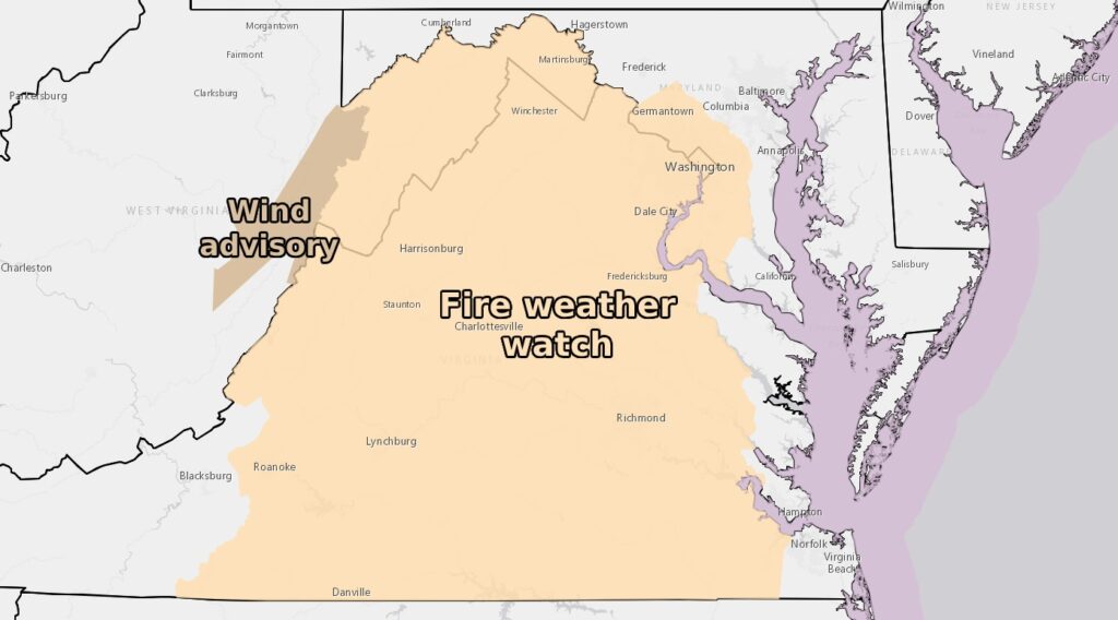
Winds could begin to gust near 30 mph starting Tuesday afternoon, increasing the fire danger. Winds are expected to peak Wednesday afternoon and evening, when gusts could reach 45 mph. At the same time, relative humidity values can drop to around 20% in some locations. Winds will start to die down Thursday, but some gusts are still possible.
Winds blowing from the west intensify as they pass through the Appalachians and rush, or “downhill,” down the eastern slopes. As air descends from higher elevations, it heats up, dries and accelerates. Many firestorms have been driven by downward winds, such as the disaster on Maui in August, but the winds caused by these fires are not as strong.
“These strong winds may result in isolated downed trees and power lines,” the weather service said in a discussion. Occasionally, fires may occur due to broken lines.
These strong winds occur as a result of the pressure difference between the storm in eastern Canada and the high pressure system sinking south of the central United States.
March and April are two of the months of highest fire danger in the Mid-Atlantic region. These risks can also occur in the fall, especially after a dry summer.
Fire weather watches are not that uncommon in our area and occur most years. Last year it was published in mid-April.
Fire weather watches can be upgraded to so-called “red flag warnings” if forecasters believe there is an increased risk of fire. The last time a red flag warning was issued for the Washington area was April 18 of last year.
March is the windiest month of the year, so fire danger is common, followed by April. As the seasons change, fronts often pass through in spring, bringing with them changes in temperature and pressure, and bringing wind.
March also precedes a major greening event. At this time of year, there are fewer leaves, which reduces evapotranspiration and limits moisture. In evapotranspiration, the planet releases water vapor into the atmosphere, exposing dry fuels (such as grass, dry plants and leaves).
The only mitigating factor at this point is that the ground is not unusually dry. The past four to six weeks have been a wet winter, with December and parts of January being some of the wettest on record. But there hasn't been much precipitation since then, and the Mid-Atlantic, Appalachian Mountains, and South dealt with a prolonged drought in 2023.
As long as winds are strong and significant precipitation does not return, we could see additional fire threats well into April.
The Bureau of Meteorology says the risk of fires can be reduced if people avoid throwing cigarettes and matches from moving vehicles, properly extinguish all outdoor fires and take other safety precautions. There is.
Jason Samenow contributed to this report.


