Severe thunderstorm warning issued for parts of four states
The storm system is creating a threat of severe weather from the lower Ohio River to the Texarkana area.
ST. LOUIS – As one storm system leaves the country, another is expected to follow it on Thursday, bringing storms to a 1,000-mile area of the country.
NOAA's Storm Prediction Center (SPC) says the storm threat is increasing in states from the U.S.-Mexico border to the Ohio Valley, including Missouri, Illinois, Indiana, Kentucky and Tennessee. Some of them are said to be most at risk.
Unlike the previous event earlier this week, when all modes of severe weather were expected, the FOX Prediction Center warns that hail, wind damage and flooding will be the main threats on Thursday. However, the possibility of some tornadoes cannot be ruled out in the Level 3 danger area, which is shaded in the darkest red on the map below.
“That area is very likely to include from St. Louis to parts of northern Tennessee and western Kentucky,” said FOX Weather meteorologist Steve Bender. “So, Paducah, we have a very likely threat again.”
Severe thunderstorms rumble across the Great Lakes, causing severe damage in northern Ohio
A “severe thunderstorm warning” has been issued for parts of south-central Illinois, far-southeast Kansas, and parts of south-central Missouri, including St. Louis and Springfield, until 8 p.m. CDT.
Additionally, a severe thunderstorm warning has been issued for eastern Oklahoma, western Arkansas, Mississippi, and Texas until after sunset.
A slow-moving cold front and recent heavy rain in the Ohio Valley could lead to flooding, especially in the northern and southern tiers.
Computer models predict 2 to 3 inches of rain will fall in Texas over the weekend.
Further north, much less precipitation is expected, but many rivers and streams in the Ohio Valley are near full capacity.
Several towns along the Ohio River flooded twice in two weeks, due in part to erratic weather patterns. Areas like Pittsburgh are on track for their wettest April on record.
How to watch Fox Weather
FOX Weather Storm Tracker captures video of Illinois tornado
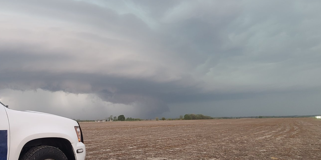
Video from Greenfield, Illinois, showed at least one tornado rolling through rural farmland between St. Louis, Missouri, and Springfield, Illinois.
The National Weather Service, which covers the area, issued a tornado warning after the sighting and said the storm was moving east at 30 mph.
Given the rural nature of Greene County, there were few structures in the immediate vicinity of the supercell.
The sighting was the only confirmed tornado on Thursday, with most of the damage reports coming from high winds or hail in Missouri and Illinois.
Storms hit the Midwest as twisters circle Illinois
FOX weather storm tracker Brandon Copic captured video of a tornado spinning through a field in Illinois.
Refreshing air mass behind the cold front
Due to the cold front, unusually cold air for mid-April has flowed in, which may make some people feel chilly.
Temperatures will struggle to reach the 60s, although recent highs in the Plains have been in the 70s to 80s.
Chicago is one of many cities experiencing colder weather, with highs expected to be 5 to 10 degrees below normal into the weekend.
By next week, cooler, drier air is expected to reach Interstate 10 along the Gulf Coast, which could bring highs in the low 70s for several days in New Orleans.


